Program Overview
Phase 1: Online Training (MOOC-based)
Date: 10 August – 6 September 2026
Mode: Online
The online phase is designed to provide fundamental knowledge in ocean remote sensing through structured modules delivered by international experts. Participants are required to complete the online course prior to attending the onsite training.
Key modules include:
· Fundamental of Remote Sensing
· Fundamental of Sea Surface Temperature and Thermal Front Analysis
· Fundamentals of Radar Altimetry
· Fundamentals of Ocean Color
· Fundamentals of Microwave Radiometric and Unmanned Aerial Vehicle Mapping
· Satellite Wind Data and Applications
· Data Assimilation
· Machine Learning
· Satellite Applications in Fisheries
· Nearshore Altimetry
· Accessing Satellite Data with ERDDAP
· Accessing Satellite Data with ArcGIS
· Getting Published in an International Journal
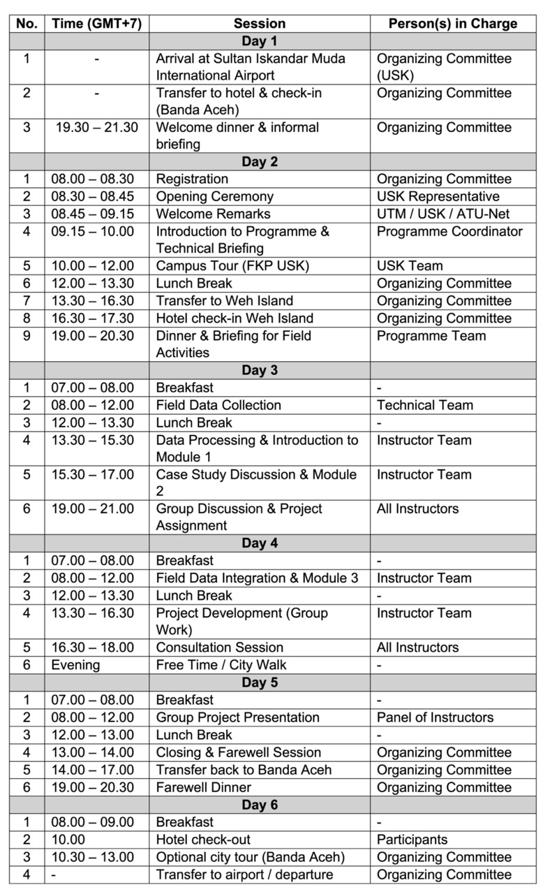
Phase 2: Onsite Training and Field EXCursion
Date: 7 – 12 September 2026
Location: Banda Aceh and Sabang (Weh Island), Indonesia
Mode: In-person
The onsite phase focuses on hands-on training, technical exercises, and field-based learning. Activities include: